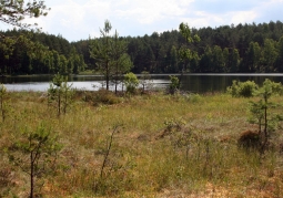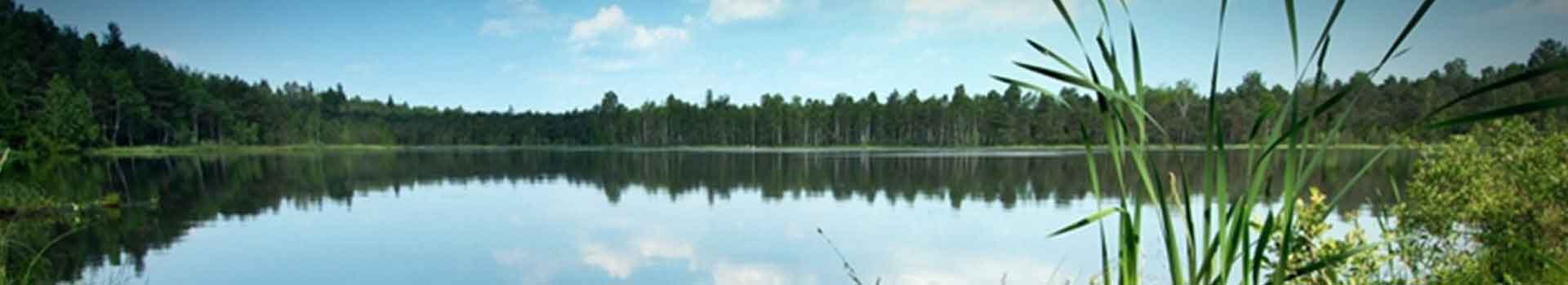

The Wdzydze Landscape Park was created on June 15, 1983. It is located in the northwestern part of Bory Tucholskie, on the southwestern edge of the Pomeranian Voivodeship, 70 km southwest of Gdańsk, in the Kościerzyna poviat. The area of the park is 17.8 thousand ha, including forests and trees cover 64% of the area, arable land 10%, and surface water 11%. The park is surrounded by a buffer zone of 15.2 thousand ha. Within the WPK are land administered by five communes: Kościerzyna, Dziemiany, Karsin, Lipusz, Stara Kiszewa and the State Forests, on which the Kościerzyna and Lipusz Forest Districts operate. By decision of the International Coordinating Council of the Human and Biosphere Program in Paris on 2 June 2010, the Wdzydze Landscape Park and the parks: Tucholski, Wdecki and Zaborski were included in the Bory Tucholskie Biosphere Reserve. It is a designated protected area containing valuable natural resources, including many natural aquatic, peat and forest ecosystems. It performs three basic functions: 1) protective - contribution to the protection of landscape, ecosystems, species and varieties, 2) developmental - creation of opportunities for economic and social development, culturally and economically sustainable, 3) logistic support - through ecological education, training, research and monitoring in relation to local, regional, national and global issues related to conservation and sustainable development. The Bory Tucholskie Biosphere Reserve is the tenth and largest biosphere reserve created in Poland, with an area of almost 320,000 ha. The Wdzydze Landscape Park mostly covers the area of the sandr plain, formed in the form of a large inflow cone by the meltwater of the Quaternary Ice Sheet. This plain is slightly sloping southwards, in a height range of around 160 to 140 m a.s.l. The basic diversification of the terrain is introduced by glacial gutter tracts, melting basins, sections of river valleys, as well as fragments of the moraine plateau in the form of the so-called "Moraine islands." The subglacial gutters located in the WPK are filled with the waters of lakes, ponds, are used by the watercourses, and often remain dry. Sandras that cover the largest percentage of the Park's surface are built mainly of layered, gravel-sandy sediments, and their granularity and other characteristics depend on the moraine material washed by the ice sheets of the ice sheet. Melting hollows after dead ice blocks have various shapes and dimensions. The larger ones are usually shallow, often filled with gytta or peat and are characterized by flat edges. Smaller sites are usually deeper , surrounded by steep slopes, and their greatest accumulation occurs in the western part of the Park. On the base of the glacial sands, which do not guarantee high fertility of habitats, developed, among others, leached brown soils and white-earth soils dominating in the WPK area. Due to the fact that they are excessively permeable soils, they are periodically too dry for many plants, have low water retention capacity and poor capillary rising ability. The agricultural usefulness of these soils is very low, and arable land does not form compact complexes, but is often distributed among forests. Factors such as the terrain and terrain, the presence of a large number of lakes, ponds, smaller or larger watercourses, soil quality, etc., had a decisive impact on the development of plant habitats, as well as the presence in this region of specific and rare animal species almost the entire Park is located in the Wda basin. In its area there are 53 lakes with an area of over 1 ha and about 100 smaller, generally drainless reservoirs called ponds. In addition, 51 lakes and about 50 ponds are located in the buffer zone of the Park. The largest reservoirs have a gutter genesis and are located along the main drainage lines. The drainage reservoirs of moraine plateaus and sanders are often located in a more dispersed manner. In the spatial structure of the water resources of the Park's reservoirs, the Wdzydze Lake is dominant, whose area constitutes 76% of the Park's total water surface, while the volume - 91% of the total resources of all reservoirs. The maximum depth of the lake is 72 m, which puts it in sixth place in Poland in this respect. Its gutters stretch in two directions - longitudinal and latitudinal, with a total area of 1,455 ha. Due to its geometry (shape resembles a cross) and size, it is unique in the Polish Lowland. In terms of the chemical composition of the waters of the WPK lakes, they represent the most characteristic type of bicarbonate and calcium in young glacial areas. The park is located in the temperate climate zone, in the influence of western circulation, under the average influence of the Baltic Sea and indirect influence of the continental climate.
No results
0.0/5
Number of ratings: 0